Lago d'Iseo and Val Camonica.
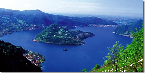
Driving over Lago d'Iseo you can expect a lot. The road from Clusone leads among steep gorges, dense forests and bare pointed peaks, at the foot of which lies the lake. Because it is the fifth largest lake in Italy, least known abroad, one would expect, that it will be an oasis of peace, but the view of apartment blocks, coastal boutiques, ice cream parlors and heavy industry plants in the first town encountered, LOVERE, puts an end to all such expectations. This does not discourage Italians, who flock to the summer resorts on Lago d'Iseo because of the famous fish restaurants, easy excursion routes and the possibility of water sports. From here you can also go to Monte Gugliemo or Val Camonica, where it is worth looking at prehistoric drawings on rocks.
The only place, which survived industrialization and the tourism industry, is connected by a ferry line (ferries depart every hour.) with the city of Iseo in the southern part of the lake, pedestrian-free Monte Isola. On this largest inland island in Italy (length 3 Miles, highest point 600 m), are located picturesque, old villages, where mainly poets live, artists and fishermen. Because there is a large campsite on the island and 200 places in hotels, at the peak of the season you can not count on loneliness, but in the off-season it is worth coming here or just indulging in laziness, or take a walk along the shore, admiring the beautiful views. There are two quite cheap hotels here: Bellavista (030/988106; double rooms 26 OOOL) In SIVIANO, at the northwestern tip of the island, and Castello (030/988154; Two 30 OOOL) In MENZINO, in the southwest. The campsite is located in CARZANO, on the north-eastern promontory (open all year round).
ISEO City has only practical advantages. Trains and buses from Brescia stop here, there is also a cheap hotel, Locanda Mirolte, on Via Mirolte (above the bar II Cenacolo; 030/980136; double rooms 21 OOOL). The AAST office in Iseo has maps and detailed information on hiking trails. The most interesting of them is the trail, which leads steep, a winding road from the half-east coast of MARONE to the village of ZONE. On site you can admire unusual rock forms, High, thin spires, which were formed as a result of erosion of boulders, brought by the glacier responsible for the shape of the Iseo basin. These spiers seem familiar, perhaps that's why, that the place was to be visited by Leonardo, who later immortalized the peaks in his Madonna among the rocks (currently the painting is in the Louvre).
Another trail from the Zone leads to the top of Monte Gugliemo (1949 m), on which you go out ok. 3,5 Hours. Under the peak is located rifugio, but before leaving the Zone you need to find out, whether it is active. If the guard is not there, you get the key from the shelter.
Val Camonica: prehistoric drawings on rocks.
Like Lago d'Iseo, Val Camonica would be extremely beautiful, if it were not for the planless construction of its lower parts by small industrial plants. The road and railway line lead from the lake up the river Oglio, through the spa town of BOA RIO to CAPO DI PONTE. Located in the distance 15 Min. walk from the town national park (Tue-Sun. from 9.00 until dusk; 2000L) has prehistoric drawings on the rock, which were formed in eight thousand years. These are the remains of the culture of the Camuni tribe, who came here fleeing from invaders from the north 5000 years BC. and survived until the colonization of the area by the Romans a few thousand years later. You can also find here even older drawings, which inspired camuni's art.
Drawings are scattered throughout the valley, but most of them are in the park, starting from the Great Rock located opposite the shop. A group of simple figures engraved on it gives some idea of Camuni's life in about 1000 years. Figures of hunters are depicted here, Farmers, priests presiding over a religious ceremony, there is also a bronze age funeral, during which the deceased was supplied with weapons and tools.
Other drawings show the development of the tribe's civilization in the Iron Age, because eg. on the rock #35 blacksmith drawn, and on the rock #23 four-wheeled vehicle, who carries the urn.
Still other drawings are located two km behind Capo di Ponte, near CEMMO in the settlement of BEDOLINO. On the other side of the Oglio there is a rock, on which there is a map from the Bronze Age with marked houses, Fields, Walls, streams and canals.